Current Researches
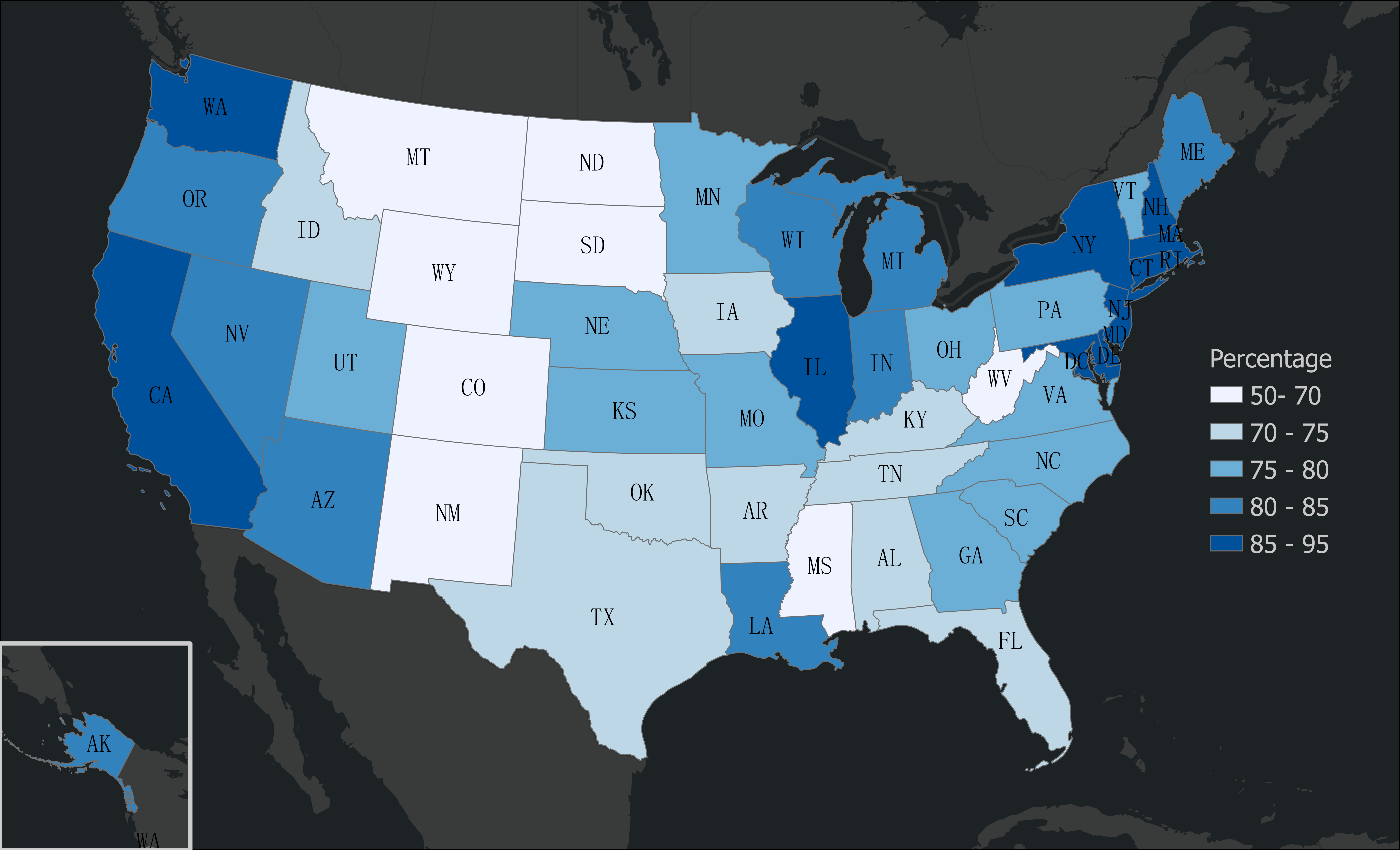
Currently, as a PhD student at UT, my research landscape has evolved once more. Now, I am directing my focus on the United States building height dataset. The expansive realm of urban planning and architecture, coupled with environmental considerations, makes this a challenging yet invigorating area of research. I am eager to contribute valuable insights and analyses to this domain.
Research at Institute of Geographical Sciences and Natural Resources (IGNRR), Chinese Academy of Sciences
Following my time at OSU, I embarked on a new chapter as an intern at the Institute of Geographical Sciences and Natural Resources, Chinese Academy of Sciences. Here, my research interest pivoted towards agricultural remote sensing.
-
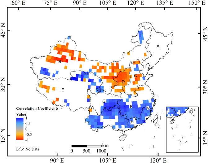
My inaugural project at IGNRR, funded by the Natural Science Foundation of China, revolved around the new grain production patterns in China. Utilizing GRACE gravity satellite data and MODIS NDVI products, we aimed to observe the spatial distributions of changes in agricultural development juxtaposed with water resources. This was pivotal in highlighting the contradictions arising due to their differing spatial distributions.
-
Following this, I embarked on a new research endeavor. This time, our objective was to employ the MODIS Active Fire product to determine the spatial and time-series change of crop residual burning events in Northeast China spanning the period from 2015 to 2020. With the Chinese government initiating a straw returning policy in this region in 2017, our intent was to leverage satellite data to discern the variations pre and post the policy’s inception. This would, in turn, enable a holistic assessment of the policy’s temporal and spatial ramifications.
Graduate Studies at OSU
Upon my enrollment at Ohio State University (OSU), there was a significant shift in my research interests towards Environmental Remote Sensing. Under the astute guidance of Dr. Zhao, I was introduced to the world of satellite data and its profound implications for environmental research.
One of the pivotal projects during my time at OSU involved the use of GRACE satellite data. With this, we aimed to detect and analyze changes in water resources within Australia. Further deepening our research, we probed into the correlation between these water resource fluctuations and the NDVI (Normalized Difference Vegetation Index) changes. This investigation provided valuable insights into the interconnectedness of natural water reservoirs and vegetation dynamics in Australia.
Undergraduate Research
During my undergraduate studies, I developed a keen interest in environmental chemistry. This laid the foundation for my passion for understanding the environment through scientific methodologies.

Fig. Spatial Correlation between Total Water Storage and Cumulative NDVI, only keep piexls with p-value under 0.05

Fig. Map shown the percentage of buildings with height info from Micrsoft Building footprint dataset across the United States